Bible atlases sometimes print a question mark after the names of cities whose location is uncertain, but they never do this with countries. After all, how hard could it be to ascertain the location of a country? In at least one case—Moab—it is more difficult than you might think.
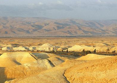
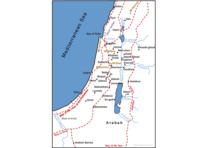
The area in question is bounded on the west by the Dead Sea, on the east by the Arabian desert, on the south by the deep canyon of the River Zered (modern Wadi Zarqa-Ma’in), and on the north by the nation of Ammon. Bisecting this area is a major east–west canyon through which flows the River Arnon (modern Wadi Mujib).
In Bible atlases, historical maps depicting the premonarchic period label the area north of the Arnon Reuben and the area to its south Moab. In depictions of the period after the rise of the Israelite monarchy, atlases show Moab stretching across the area both north and south of the Arnon, suggesting that Moab expanded northward during the monarchic period. Bible dictionaries typically refer to the southern plateau as “Moab’s heartland” or “Moab proper.” But evidence from the Bible and a Moabite inscription call into question this widely accepted picture.
First, Numbers, Deuteronomy, and Joshua all refer to the Jordan valley north of the Dead Sea as the “Plains of Moab,” presumably because it was a part of Moab. The Balaam story in
Second, an oracle against Moab in
Third, a Moabite inscription written about 850 B.C.E. celebrates King Mesha’s conquest, expansion, or fortification of 17 cities, and all those that can be identified lie north of the Arnon, including Mesha’s capital city, Dibon. The inscription gives no evidence of Moabite control south of the Arnon.
In short, evidence both within and outside the Bible indicates that Moab’s heartland lay north, not south, of the Arnon. Perhaps Bible atlases will someday reflect this.
Bibliography
- Smelik, K. A. D. Converting the Past: Studies in Ancient Israelite and Moabite Historiography. Leiden: Brill, 1992.
- Jones, Brian C. Howling over Moab: Irony and Rhetoric in Isaiah 15–16. Atlanta: Scholars Press, 1996.
- Dearman, Andrew, ed. Studies in the Mesha Inscription and Moab. Atlanta: Scholars Press, 1989.